Thursday, August 23, 2012

BC trip Hike 1: Stein Valley Nlaka'pamux Heritage Park


The lovely view from our room at the Holiday Inn morning of the trip
      We began or trip by flying into Vancouver and spending a few days exploring there. We hiked in two large parks, Stanley Park and Pacific Spirit Park, saw the Museum of Anthropology went to Granville Market and ate some awesome meals. We enjoyed the city quite a bit and found it easy to get around on their mass transit system.
  
     We rented a compact and fuel efficient car (Toyota Yaris) for eight days and began our explorations of the province. We started by driving up BC-1 for 260 km (about 3 and a half hours northeast to the dry BC interior. While most are familiar with the dramatic rainforest and Alpine Lakes, the dry interior reminded me more of the not so distant rockies than anything.

     The hike started with a cable ferry across the roaring Fraiser River. Just days earlier the ferry wasn't running due to spring run off. Once over the river we were on first nations land and were greeted by some obstinate cows not really interested in letting us pass. We drove about 10 km on dusty roads past ranches teeming with beautiful horses, cows and dogs and well worn houses and farm buildings. We reached a well developed and signed trailhead with an expansive view up the valley. Stein is a curroption of a native word meaning hidden as you can't really see the mouth of the valley from the Fraiser.


The start of our Stein Valley Journey. Little does she know...
 

      We began our hike damn well exhausted. We had not truly recovered from our jetlag, had urban hiked around 15 miles over the past two days and Jeanette was still battling a bad cough she had picked up after Camp Bisco. We were a site for sore eyes. They hike was pretty though and blessedly mild both in difficulty and weather. There was some rain in the forcast but nothing more materialized then a few fat drops. It was very dry and I was sweating pretty good from the heat. It was definetly a weird climate for those used to the Adirondacks. The subtle differences in vegetation and landform were really cool to notice. Nothing was completely alien but everything seemed slightly shifted or intensified. Trees bigger, different bark, even a slightly different raspberry-type berry. It kind of felt like we were tripping. 

       We purposefully took as much time as we could, more like strolling than hiking and reached the Devil's Starcase Campsite 3.3 miles invery grateful to take off our packs. The campsite was completely and looked like it could accomodate at least 20 tents. There was a really nice pit toilet and a large steel bear vault with a very tricky closure. If I could barely manage I felt good abour our chances with the grizzlies.

     We got the tent set up in no time and before settling down to read for a while before bed, Jeanette went down to the river to take it all in for a few. We had both relaxed and I knew the river would be a pretty spot so I decided that now was the time. Squirrelled away in my pack was a 70's era Kings Massana turquoise Navajo bracelet made by Dorothy and Donny Smith, a husband and wife time active from the mid 60's to the late 80's. She was about to leave as i made my way down. She smiled and decided to stay for a moment and looked back at the river. The rocky, rooty and uneven proved a bit more of a challenge than I had anticipated and it took some effort and fanagling to get down on one knee. Just as I got situated she turned around with barely a moment to make a slightly perplexed face before... "Jeanette Carioto, moon of my life, will you marry me?"


Kings Massana Turquoise and Red Coral "engagement" bracelet


The start of our next big adventure
         We hugged and cried for several minutes and then both kind of chatted in a happy haze. We had packed in some beautiful meatloaf and beet salad from the Whole Foods next to our hotel and settled in for our engagement dinner at our kindly provided for dinner table. At this point in the night while camping Jeanette often reads for a bit in the tent and I'll go explore the area around the camp site. I almost always find something cool to look at or make friends with some bird or animal. Just west of the campsite was a large talus slope. I climbed up to an inviting rock about 150 ft upslope and snapped some pictures, taking it all in. The cliffs, the river the trees...this was a truly beautiful and peaceful place. The Stein River Valley is one of the few intact watersheds in British Columbia and mid week we had it all to ourselves.


At the dining room table looking over the hike


After dinner explorations


The Stein River is impossibly blue
           The next day we began or hike by immediately climbing "The Devils Staircase", a section of switchbacks clinging high on the slopes of the valley. Though it wasn't exactly brutal hiking we took our time and enjoyed the dramatic and peaceful views. That morning at camp we had seen a huge raptor and think it may have been a golden eagle. High up on the hillside we saw a bald eagle far below us.


High up on the talus slopes above the Stein
       After getting off the staircase we reached our primary destination of the day. Thankfully I had read three different guide books because the intersection was completely unmarked. As one account from a guidebook said, turn right and step over the fallen log, following the path to the base of the cliffs. Here we had reached the largest petroglyph site In Canada. The First Nations people still living nearby had sent off their adolscent boys butt-ass naked into the Stein for their vision quest coming of age ritual. Here sleep deprived, fasting a exposed to the elements they had drawn on the cliff walls using a mixture of red ocher and water. Jeanette and I are anthropologists and this was a truly special moment for us. We marveled at the often very accurate representations of animals, warriors dancers, the sun and intricate geomoetric shapes and patterns. Each step we took along the cliff edge we discovered more glyphs from our kness to high above our heads.


One of the first we saw


the rock was covered when you took a step back


one of many human figures
      After poring over the drawings for a long time and also sitting back on a rock to take in the total picture we eventually started to make our way down the trail. Now back close to the river again we made our way through several different types of forest. Towering pines surrounded us in one particularly lovely stretch that would give any stand of white pines in the ADK a run for it's money. It was one of my favorite places on the trip. Since this was part of a large Northville-Placid type through hike we didn't really have an end destination. At the site of an old prospectors camp we rested and turned back.


The cliffs at the edge of the Cantilever Range soaring above us


These are "culturally modified trees". Though these trees exist elsewhere in the area, the first nations people living outside the valley chose to come here again and again to collect bark some 5 miles from the nearest house or road.
       

Looking deep into the Stein River Valley


ever rushing waters
  We returned for another long and relaxing night and camp still buzzing from our engagement and our stunning trip exploring the wonders of this sacred valley. I returned to my perch and thought about all I had to be grateful for, all that had happened this year and all of the brightness in our future and felt peaceful and at ease in my core. The next day was fantastically pretty and after a leisurely breakfast we headed back to the car. Our next step would be to drive due west, north of some of the tallest mountains in BC and head south down through Whistler to stay in Squamish and hike in Garibaldi Provincial Park the next day. This drive was jaw-droppingly beautiful and rugged as anything I had ever seen. We twisted along hillsides far above the Fraiser River and witnessed an ever-shifting mountainscape unfold before us.


waiting for our ferry to return


One of many views driving between Lytton and Squamish


Wednesday, August 22, 2012

The Santanoni Range: Our 46er Finish 6/09/12


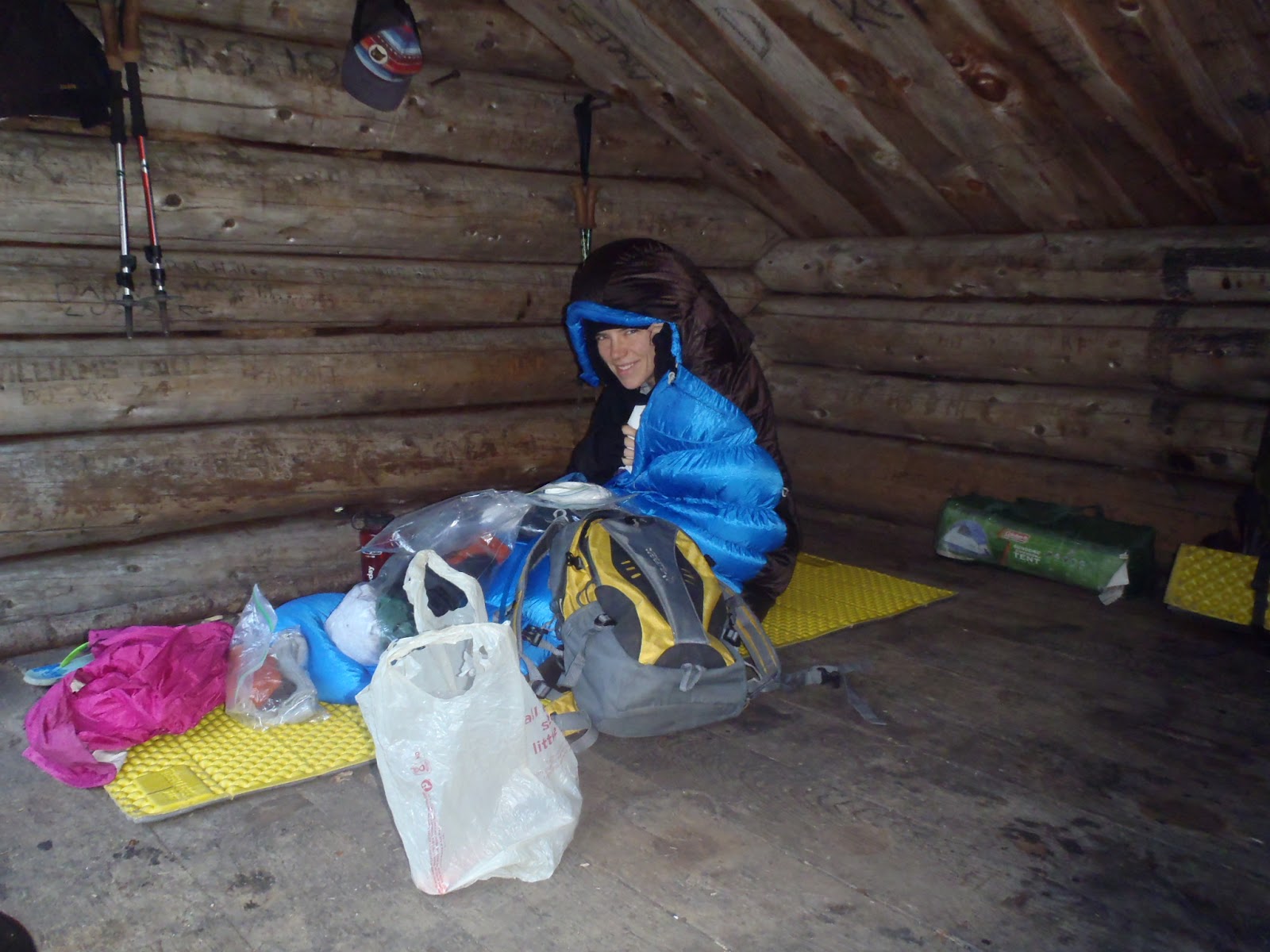
    We started our hike late Friday afternoon under fairly sunny skies though there was some rain in the forcast. Once we got under way, some gray skies started rolling in, getting more and more threatening. The first portion of the hike in is along a road and goes fast. There is a hard right onto the trail proper which started out pretty and got awfully rugged (muddy, rocky and heavily eroded) awfully quick. I think we both had a lot of nerves about our last big trip of the 46ing journey and hadn't seen each other for a few days so we bickered a bit on the way in. I made some sort of smart ass comment about how it was going to rain soon and we both started picking up the pace. Thunder rumbled more and more intensely. About a mile before the lean to, a significant reroute was marked around some even worse trail. We pushed through scrubby pine and swung off of trees to keep our balance while trotting with three days worth of backpacking gear. We started to get kind of giddy in our race to the lean to and any animosity or irritation between us dissolved as the rain started to fall. Before we got too wet we reached the lean to. As we did, it immediately started raining harder. We gleefully settled in for the night. We had passed two guys on the way in who got to the lean to at the begining of the storm too. We immediatly invited them to share it with us for the night but they seemed intent on setting up their tent so we had it all to ourselves all weekend.

       The next morning we got it together pretty early and got on the trail. On the way in, at the reroute start, there was a small cairn. I assumed that this was the start of the herd path to Times Square though I was a little unsure as it was pretty small. I was able to rationalize that since there is now a trail reroute, the herd path start probably got a bit rerouted too. Here, me being overconfident got us into some trouble. First off, I hadn't checked any trip reports beforehand which I had been pretty vigilant with over our last handful of trips and the info had been pretty valuable. I might have gotten better info as to herd path start and how it was affected by the reroute. Secondly, I didn't pull out the McMartin map, sticking to the ADK map. The McMartin map has the herd paths and I would have very quickly seen my mistake. I left it in the freaking lean to.

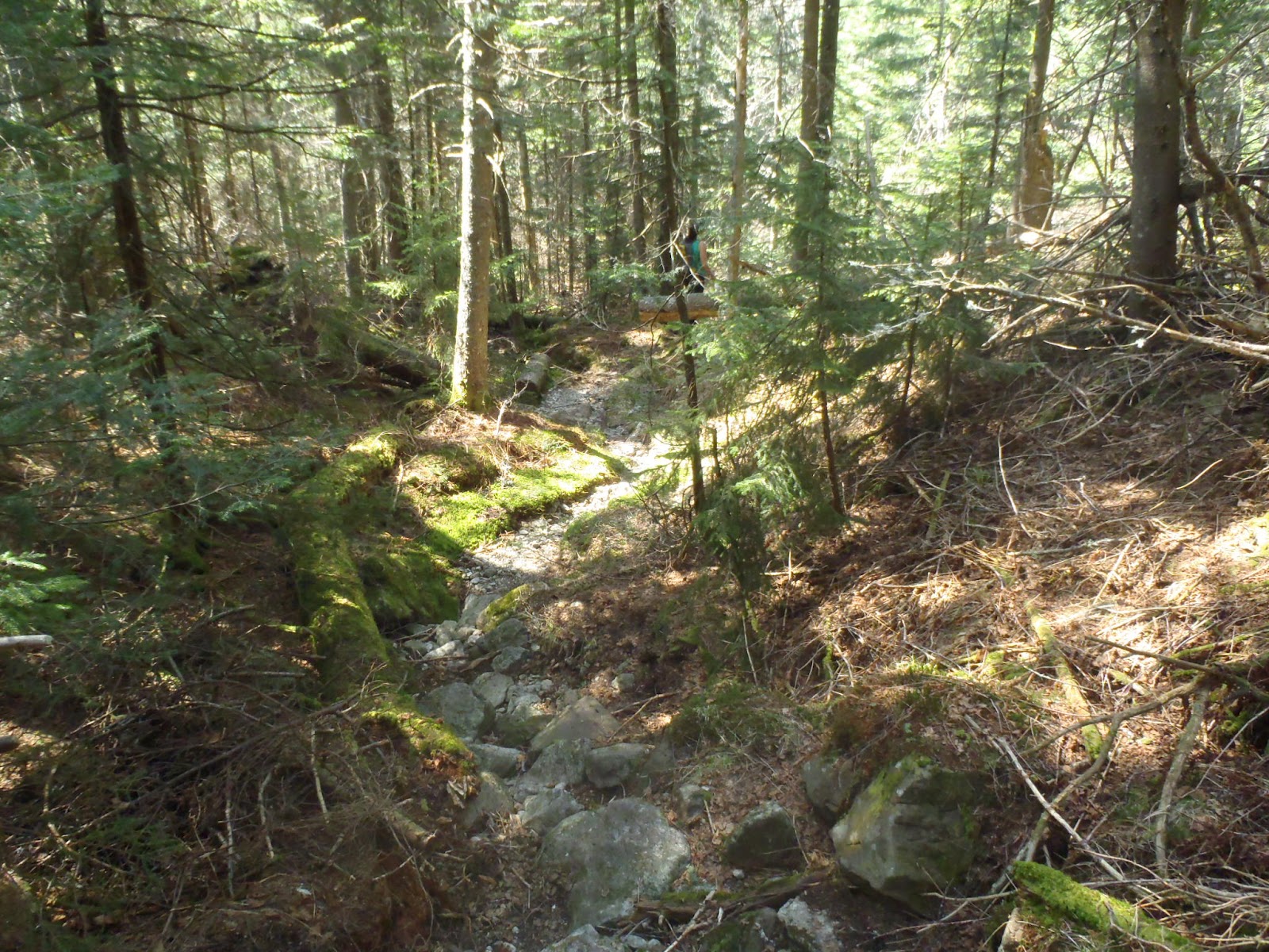
     So we headed into the woods at the cairn and quickly lost any sign of a herd path. I was still sure that it was nearby as I thought I remembered that the herd path went south of Bradley pond. So if I took a bearing, stayed south of the Pond and hit Panther Brook, I'd HAVE to stumble into the herd path. The trees, christmas tree sized pines, were heavy with last nights rainfall and dew and quickly soaked me as I pushed through the brush. Jeanette trusted my judgement (oops) and followed but I can't say that either of us were pleased. We followed the southern shore of the pond and got some pretty sights.  


A boat stashed in the woods in what looks like ship shape.


Impromptu Bradley Pond bushwack
           We reached Panther Brook where it feeds into Santanoni Brook just south of Bradley Pond and began to follow it up still with no herd path in site. All throughout this I was checking my GPS constantly. Here I was, overly depending on it (which I've made fun of other people for....karma'd) and getting in trouble because of the warm and fuzzy feeling of having a dot on a map telling exactly where you are. We slogging along the banks of Panther Brook, crossing from one side to the other, looking for the herd path. The banks of the Brook became increasingly steeper with cliff faces rising to our right and it eventually made more sense to simply climb up the rocks in the stream. We paused for a snack and to get our heads back on straight. Surely the herd path would eventually cross the brook, probably after we rose out of the deep valley we had entered. Our hopes were based on our experiences with the Herbert Brook, Seward and Redfield herd paths which all follow brooks and cross at least once. Even if we didn't find the path I'd taken a way point for times square and between the GPS, compass and map i was confident we could hit the point. The strategizing and snacking were just the refresher we needed and spirits were well on their way to lifted as we stumbled upon backcountry gold: a cairn!!!!! Back on track folks.

Those are some lovely cascades...lets climb em!


Jeanette before and after shots: before finding the herd path
 

After finding the herd path!!!!
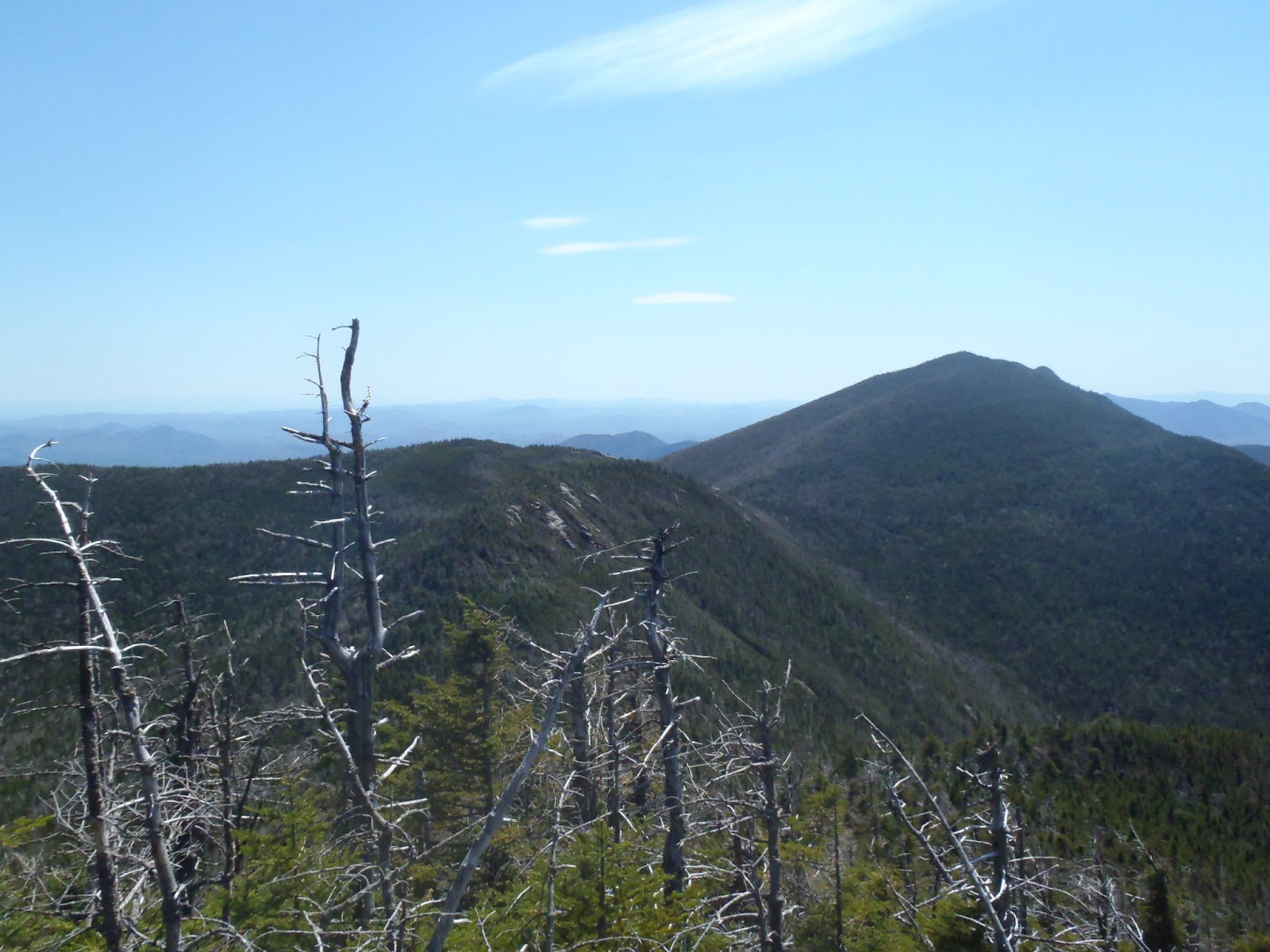
     I'm sure that our happiness and relief for finding the herd path colored the experience but from that crossing to the top went quick and felt decently easy. We got to the big interesction, rested and snacked and made our way down to Couchsacraga. This much maligned peak turned out to be pretty enjoyable for me. I do understand though how looking DOWN the long ridge from Times Square has taken the wind out of many a sail. We made what I felt like was good time, taking in some lovely and remote views of the Cold River Valley and the Seward Range. Up to the summit and yay! It was a pretty good one with a fairly open rock you could get a nice 360 from. I had been dragging energy wise and ripped into our new go to trail protein, foil packet tuna in sunflower oil and a little broth. Doesn't sound appetizing but when your body is craving/ needs a big dose of protein, it's freaking amazing. Met some nice guys and a dog, the guy was a 46er and his nephew just climbed his second and third, Santa and Couch! Whoa, he's gonna be glad he got those out of the way early on.


Almost to Times Square, the view back towards Bradley Pond, the Mac Range and beyond.


an ocean of fog


Cold River and the Seward Range
        With a fully belly and some bubbly conversation (Jeanette filled me in on the two episodes of HBO's Girls I had missed haha) we made our way back to Herald Square and began our trip up Santanoni. It looks huge from the first ledge overlook heading in that direction and I think we were both a bit intimidated. This climb though, like Couchy went relatively guick and uneventfully. Other than how awesome it was!!!! Freaking great views from this mountain. On the ridge trail we saw some painted trilium which was interesting as I'm used to seeing them much lower and near creeks. Jeanette nearly ran up, her excitement for being so close to our 46 un containable. Pretty summit and more chatting with nice folks. It was fun telling everybody how close we were.

    We rested for a while and like Allen, got visited by a summit bird.  Jeanette (and I) were very curious about a certain bird song we often herd in the Adirondacks. As a kid, my dad would whistle back to them and convince my sister and I he was talking to them. Which I now do to Jeanette haha. So this little bird with these brown almost hawk like wings, a striped black and white head and a yellow spot on it's cheek hopped around us for several minutes. It took off, perched on a nearby branch and lo and behold, sang the ellusive song! We now had all the identifiers we need to find out what kind of bird it is. It's called a white-throated sparrow. About a month later we decided to climb Phelps for sunrise and while we were completely socked in, we were visited again by WT sparrow and were treated to an extensive serenade which Jeanette managed to film. Such special moments!


Summit trillium?


The view from Santanoni; Pure wild Adirondacks
      Now all that we had left was to climb back down to Times Square and up A short distance to Panther. This is the sortest of the three ascents and I was stoked to be so close. Down in up with nothing particularly memorable other than our excitement. We celebrated on Panther, posing with our flag and swatting the occasional fly. You'd like to say that you sat back on your final summit and reflected about the long journey but I guess I really didnt though that happened plenty before and after. I took it in like any pretty and hard fought summit and we made our way back to camp. 


Santanoni from Panther
       I was curious to see what the trail was like on the stretch we had missed going up the creek. Well it turned out to be a pretty and moderately easy stretch of trail. It was well to the north of the creek for the most part, avoiding the cliffs that had pinned us in. Using our trail-finding "strategy" while we were "off-trail" would have NEVER led us to this path. Sometimes it seems like you do the opposite of right every possible time when something goes wrong and sometimes you feel like everything went miraculously right when the flows are flowin'. We got down to the pond and crossed the beaver dam. Turns out the herd path started pretty much right in front of the lean to, which i would have know if I had consulted the McMartin map before hand. Guess now I'll know for the next time haha. All things considered it could have gone way worse. We probably added about an hour to the day and one or two gray hairs.

     In the lean to that night we cooked a nice dinner, at some chocolate and drank a bottle of Finger Lakes ice wine I had gotten for Jeanette for Christmas and took in a lovely and restful evening alone in a lean to. I guess I didn't spend much time reflecting on the past because I feel in the middle of a fluid lifestyle more than someone who had just closed a door or finished a chapter. As I sit here writing this, I'm planning several camping and hiking trips for the coming months and beyond. I love these mountains with all my heart and feel so grateful for how they've changed me. I feel like I am finally a man. A man shaped by mountains, mud, weather, exhuastion, exaltation and solitude.

Wednesday, May 16, 2012

Dix Range in Pictures 5/11-12/12


Slide Brook Lean to


New spring growth next to the lean to


A bridge returns to nature


Painted Trillium


Perfect woods


A cold morning start


First views of Elk Lake from Macomb


Macomb's famous slide


Rock star!!!!


The view north


uninhabited


The Dix Range from Grace


Grace from Hough


mossy roots


Looking south towards macomb


Summit of Hough


My partner in crime


Lillian Brook herd path


Thursday, April 5, 2012

Haystack 11/5/11

           Crystal, Mike, Josh, Caroline, Jeanette and I booked Camp Grace on the ADK property @ Johns Brook Lodge for 2 nights, starting on Friday. We hiked in after work. The hike went smoothly until we crossed the suspension bridge over Johns Brook. From the simple hand drawn map of JBL property, we weren't able to find the cabin. We walked back and forth, tromped around the woods in the vicinity of the lean to's, walked all the way to the western crossing by JBL, walked back to the bridge etc. We finally decided to follow a trail that looked on the map like it went to the private camps. In fact, it was Grace Camp!.

      We settled in, enjoying the wonder of this strange little nook in the woods. The cabin has 6 bunk beds (2 triple stacks built into the wall), a large table, propane heat, lights and a two burner propane cook top. We booked a lean to a few weeks earlier on our trip up Basin and Saddleback and found it to be a great experience. I highly recommend either the cabin's (Peggy O'brien is the other and sleeps 12), the lean-tos or a bed in the main Lodge. The main lodge gets cooked hot breakfast!!!

    More info, reservations and rates here


Our Bunk beds at Grace Camp
        Whiskey>chocolate>bed. The group wakes up with some tender encouragement from yours truly. Mike and Crystal decide they don't feel great and are going to scale back their day by climbing Saddleback. We go our separate ways. It's very crisp out, bright and cold. The world is quiet and their is no one in the woods with us. We make good time on the increasingly steep trail. As we get higher things get more and more frosty.

Named after Grace Hudowalski, quite a woman. 


the mud is frozen, winter is coming

     Now that we've approached Basin and Saddleback and Haystack via this route, it's one we will keep using. A steady and pretty way to access the lower range. We don't encounter any serious ice until the range trail. Jeanette put her microspikes on and kept them on. The rest bare-booted with some slipping but not too much.

at the heart of things


Basin from the Hatstack approach. I love frosted trees
      While planning this trip I consulted the message boards for their sage like wisdom (and humor). Procook from the high peaks forums said that the nub before Little Haystack and Haystack is his favorite place in the Daks. It did not disappoint. The entire final ascent was epic and beautiful and we were fortunate not to have any wind. We could clearly hear and see folks on Marcy.


Little Haystack and Haystack. Reach out and touch


Album cover shot
  We were able to spend almost an hour on the summit, admiring the views of Marcy, Basin, Panther Gorge and so much more. The hike out didn't leave any lasting impressions so I would assume that it was lovely and not too tough. We returned to a warm cabin, as Mike and Crystal had just returned.


rythm
        Good dinner>stories>whiskey>more chocolate>bed. We woke up to another beautiful day. We cooked a big breakfast and cleaned up our wilderness hideaway. It was nice to hike this trail in the sun for once and all ambled along, taking it all in. This was our last "hiking season" hike of 2011 and one of my all time favorites to remember. The company, the cabin and the views will last a life time.


hard to leave a perfect place