Monday, March 31, 2014

Cliff 3/29/14 (Koda #38)

Jeanette and I climbed cliff and Redfield in March of 2012 in pretty ideal conditions. Well broken out trails, supportive snow pack and warm temps. We spent an awesome night in the Herbert Brook lean to. It was pretty obvious right away that this would be a little different March hike. On the drive up there was a good amount of standing water and some black ice on the road indicating the peaks had gotten a pretty good amount of rain.

I got geared up at Upper Works and  tried to keep the excitement explosion (Koda) quiet as some guys were sleeping in the car next to us. At the sign in you could see how the snowpack had been significantly affected by the rain. A layer of crunchy mush marked the snow/ rain interface and wave-like channels like sand on a beach gave visual clues to how it all drained and moved.

On the trail, there was about 3 inches of slushy snow in the "groove". I had all kinds of big dreams of rocking a good time on this hike. I crunched the numbers and figured I could do it in 8 hours. Best laid plans of mice and men eh? My goal shifted as the sun rose over the trail. Get pictures at Flowed Lands! Seeing Marshall from the first hill, I could see dramatic drifts of mist swirling around the Macs under bright blue skies.

Sunrise on the trail to Flowed Lands

We clomped along, revisiting favorite spots and soaking it all in. The Calamity Brook crossing felt quite solid. Before long I was in a big open area I couldn't ever remember being in. It was Calamity Pond! The trail was broken out along it's bank and I didn't even notice. As I looped back, the normal trail wasn't even broken out in that section, people had all just taken this 'winter route'.

Out on Calamity Pond

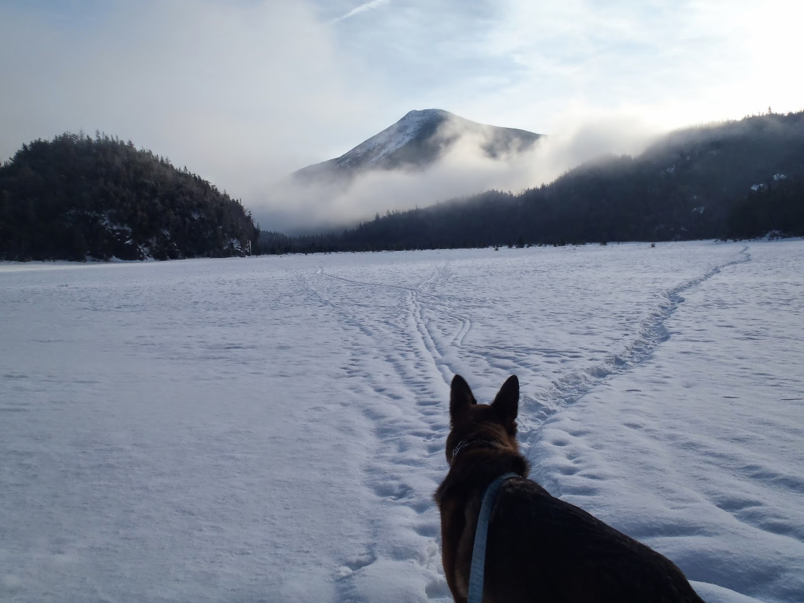
The view from the edge of Flowed Lands did not disappoint. Colden was wearing am ever-shifting skirt of mist. We signed in and I noticed the only recent activity was the Lake Colden caretaker. The trail around Flowed Lands wasn't broken out so I followed the caretakers tracks across. We followed the single snow shoe path across sometimes sinking almost a foot into rotten snow. It made for some uneasy feelings but I figured if the caretaker had felt comfortable crossing the day before, it was probably solid. The Ice deep under the snow turned out to be very solid from the long, cold winter.
Choose wisely young pup
Colden and the dance of the seven veils 
 We visited the Livingston Point lean to on the way and I remembered camping at the designated site there when a group of us climbed Marshall (on that climb we met procook and joecedar maintaining the trail). The first time I crossed Flowed Lands it was a direct line to Herbert Brook lean to. This time, I got what I had hoped for: the track went to the east shore, up through the designated camp sites and past the lean to. I got to skip the ladder down the dam! Koda was pleased. I think he takes getting carried down ladders as a personal insult.


To the far shore
Avalanche pokes her head out

Now for my favorite trail in the high peaks (Round Pond>Dix is a contender too)! The suspension bridge had about 2 feet of snow on it which was thankfully supportive. It made for an easier cross for Koda and I slightly more nerve-wracking cross for me. All safe across and we enjoyed bright sunshine pouring through the trees as we climbed along the dramatic and winter-stilled waterfalls and gorges of the Opalescent. All of the "trail-breaking" (I guess it's not true breaking if it's only a few inches over a solid track) had caught up with me and I was much more tired by the herd path start than I usually am at that point on the trail. As we had climbed higher, it had gotten less sunny and mistier. At the start of the herd path, we were completely in the mist with about 100ft of visibility.

I saw what I thought was a faint track (uh oh..doesn't look broken at all) and followed it into the woods.  I pushed through deep snow looking for any indication of the trail. No such luck... It looked like we may be shut out on this one. I tried to stay calm and not get disappointed. I decided to just keep going up the red trail a little further to make sure I hadn't broken into the woods too early. Sure enough, a much less faint trail was just another 100 or so feet up the trail. It was just about as broken out as what we had been on all day so I was grateful. It'd be a hard-fought summit but we didn't have to quit.


100% ADK: late winter edition.
"Chris, where are we?" "Koda, I have no idea." 

Off we went, hugging the shore of Uphill Brook. I thought the trail went too far up the brook and turned back thinking I missed the Cliff intersection. Nope, I hadn't gotten there yet. Back up I went. There was some nice open woods and clear trail until the hard right to start the climb.  Cliff. Here there was a tree down that semi obscured the trail. We ducked under but not before some floundering off trail.

 The climb was pretty straightforward: the usual cliffs had some grippy snow covering the sketchiest parts so while a bit precarious, I never felt dangerous. For the entire day my MSR Evo snowshoes were more than enough. Koda's built in snow shoes did fine too. He often took the lead that day which was a little different. Usually with deep snow he falls in and lets me break trail. Today he made a bee line up the peak and I was decently grateful for his paw prints which gave me purchase on steep slopes several times. Hero dog!!! CoryD got me thinking about his pads so I brought some vaseline just in case and checked them regularly. All good!

Up on the ridge, things were a little less straightforward. Rain and drifts had all but eradicated evidence of the trail in many places. I kept losing the path and plunging waist deep into spruce traps. After wandering in what turned out to be a complete circle (I had double back on my own track!), I finally had the sense to take out my compass and get a bearing for the summit. After that, every time I lost the trail, I'd check the bearing again and use that to choose my path. I had been simply stumbling around the false summit. Quickly now we made our way off it and started climbing the true summit.

It was a challenging climb, which made it all the sweeter to see the sign and disc. Despite it being socked in, we spent a good 20 minutes up top, reflecting on the hike and looking back on our winter hiking season. Koda got his normal kibble and also a special treat: a pigs ear. He got a pigs ear on Redfield in November so it looks like we have a tradition for these two peaks.

Yesssssssssssssss!
The view from Cliff is actually pretty sick. I just sketched it in from memory.

 On this climb, I felt like I not only learned a lot (I still learn SO much every time I hike) but was able to use past experience to aid my way. Having confidence with the compass made it so I never panicked when we were "turned around" on the summit. I'd say one big lesson I took away from this one was not to be so casual with planning. I figured I knew the route pretty well so I didn't run through a few old trip reports or read the guide book for landmarks, mileage etc. Once on the herd path, I wouldn't have had to turn around and make sure I didn't miss the turn to Cliff if I had just spent a little more time preparing.

I wouldn't trade this hike in for an easier version of this hike though. It was a great experience. It felt good to put all of the endurance I had built up all winter and all the experience through the years and hike the hell out of a challenging hike. And still learn. The story goes on though. We made our way back across the summit ridge. Laughing at the floundering track that had caused so much strain not so long ago. I X'ed out all the bad tracks and worked to really lock in the right track for the next hiker (though with how much everything changes each day at this time of the year...who knows). I carefully picked my way down the steep descent. No deliberate but slides but definitely at least 2 accidental.

After summiting at 11, I crunched some numbers again. I could still make pretty good time despite the conditions! I shot to get out of the woods by 4, making for a 9 hour day (in the end, we got out at 3:40 so a little less than 8.5 hours of hiking time). Knowing I had a home-cooked meal waiting for me when I got home was a strong motivator as well. J was going to base her cooking plans around when I sent the out of the woods message on my SPOT. Awesome wife. I was tired and my muscles felt like overstretched rubber bands but it still felt good to move. There were ski tracks on the main trail when we got back there, they looked to be the only others up that way on Saturday.

We flowed like water along the bank of the river, sometimes trotting a little, sometimes pausing at a drop and wonder how far down to the water. Back over the river, through the camp sites and out onto Flowed Lands. What a sacred place. It draws me season after season, year after year. I didn't quite want it to end and hung out on the ice for a while with Koda, once again thinking about all the hikes this winter and through the years. He posed for some pictures.


Showing off our "mega-leash" system
Total goof ball
Slightly more majestic here
The views had changed dramatically over the course of the day. Colden had put her veil back up, so I guess it was time for us to go. Along the path and down the hills, crossing the brook one last time. The next time I see all this there will be flowers. and mud. and flowing water. and a lot of mud. Though once again, I wouldn't wish away this day for anything, I can't wait to see what's next!

Show's over boys. 

Wednesday, March 5, 2014

The Dix Range 3/1/14


Denise, her friend Joe and I met at the Clear Pond trail head at 5AM in negative temps. We quickly got moving to warm up a bit. The road walk went quick, with conversation passing the time well. At the summer trailhead, the snowshoes went on and we signed in. The sky was starting to get light as we began to move down the hard-packed trail. Through the trees, white domed summits glowed in pink light and the array of slides on Macomb were illuminated.

At the herd path start (well broken out and obvious), we met up with Mark, who was climbing Dix and Hough. At the end of the conversation, we realized we'd met at the end of our respective Seward range hikes (he had climbed Seymour, me the other 3). I think we were both tired then and actually hadn't taken a good look at each others faces.

We followed the herd path, which was interlaced with ski tracks which often disappeared into the woods. Looks like they were having fun. Before long, we were at the base of the slide. With all the avalanche danger warnings, I had some nerves about it, but from studying trip reports from the past and making some key consultations, I got the impression it'd more likely be windblown, with some of the rocks exposed than slabby and slidey (mad scientific right?).


The Macomb Slide


At the base of the slide, it shone like glass in the early morning sun. I was queasy, queasy, queasy. So was Denise who has no love for heights or exposure. Joe, who was soft-spoken and sweet, was the only one of us who appeared un-phased. We began making our way up, keeping a safe distance from each other, in case we dislodged anything or began to slide. The ice that covered it proved to be a thin sheet from the rain last week and easily punched through to grippy snow underneath. I followed the cairns and a vague trail left from the previous climbers. I had koda on leash so I'd worry less, and he let me know (by loudly whining) he'd handle it better on his own. he punch-stepped through the ice like the rest of us and I'm glad, in the end, to have had him close to me.
The beginning of the slide climb


Denise and Joe following our tracks


As we got further up, the familiar view of Elk Lake and the peaks to the north-west opened up in all it's dramatic splendor. When we climbed this for our regular round, I didn't know the peaks as well, and it was really cool to appreciate this unique perspective for me, of haystack especially). We made it to the steep headwall and the left cut-around without incident and celebrated with a deep breath. The trickiest part of the day was over! It was just walking from here on out.....or so we thought.

Frozen Elk Lake

The Eastern High Peapks
The slide head wall. Glad we didn't have to climb this!

After enjoying the cold, windy summit of Macomb, we began making our way towards Carson...sort of. We kept following paths that petered out. Like really obviously came to an unambiguous end. We did this for half an hour, taking compass bearings, checking and re-checking the map, going down each "path" again and again. We had finally given up and were going to bushwack a compass line to the visible and obvious rocky southwest end of Carson when we heard someone reach the summit. It felt great! I figured it was Tom and Laurie, who I knew were climbing Macomb that day, and had a lot experience in the mountains, might be able to help us.

Turns out it was this really nice guy Brad, who had stayed at Slide Brook lean to the night before and was going to spend the night at the Bivy site in the Pough/ Hough col . He immediately agreed to join or whack party but as he was enjoying the summit, shouted over to us: "I think it's right here!" Turns out the trail started really close to the summit, had blown in, and immediately dropped down and around a corner, making it sort of hard to see. We were elated to be back on track and quickly made our way down,  Several times on the way down, the trail was a bit ambiguous or blown in. After easy strolls (well lets not ever call them easy) through the Santa's and the Seward's, I finally got a bit of a taste as to how the trail-less ranges can really be.

We found our way up on the rocks and picked our way up, amazed at how little I remembered from my first time out. Some cairns and ocasional tracks marked the way. Not too long after the rocky climb, I thought I heard someone shout "Hey Chris!" I dismissed it as it didn't seem to make sense as another hiker emerged from the trees and asked to join the party. As he got closer, I realized it was Pete, who we had met coming off Wright several weekends before. Our party had now grown from 3 to 4 to 5! So cool!

Open rock on Carson

This range has amazing views!

Hough, Dix and beyond

We found our way back into the tree-line, noticing the trail over to Pough and Hough breaking left. One more navigational challenge knocked off the list. At this point any easy find was greatly appreciated after our early stumbling. A quick break on Carson and several pictures snapped, including Denise and I's poster shot. Off to Grace and the trail was at times blown in and hard to follow. it would come and go, but with some care, we could find it. We followed some snowshoe hare prints for much of the way. About 3/4 of the way over, we ran into Ben W and his buddy, who were re-tracing the project 46 traverse the other way around. Nice to meet you guys!


Peak #1 for the Gathering, Carson!


South Dix isn't much of a name. No wonder they're changing it!
snowshoe hare tracks along the herd path


Hough, our final peak, from Grace.

Now the trail was broken out and we eased into a nice steady pace full of gratitude. From this point on, navigation was no longer an issue...for the most part. We all refueled short of the ascent, Ben telling us it was super cold and windy on Grace. Up we went, noticing the herd path up from The Rte 73 approach was broken higher up from the usual spot, creating a short cut courtesy of Rik, Inge and company. The summit was windy as promised.
                          
The re-climb of Carson was quieter (at least for me) as the accumulating miles took their toll. Another snack and Carson and a quick right not far past the summit. Up and over the bumps made for some needed variety in the hike. The overlooks are so cool from Pough. Down in the col, I was glad to see a very clearly broken out Lillian Brook herd path, which also appear to be broken out in a slightly different place than where it is in the summer, coming up a bit earlier from the Pough side. Brad was home for the night! He started to set up and we once again snacked. Koda got his main meal of the day, a 3 serving tuna packet, to fuel the final push. He wasn't thirsty much on this hike but finally had a big drink which made me happy.

Time for the last peak of the day and probably the steepest climb. Up and up, over a false summit and the tricky rock spot. It was tricky and very windy. We helped Koda up, and talked Denise up the spot, her fear of steep exposure reminding me of Jeanette's troubles too. This is real and scary stuff! Especially in the winter. I came down at one point to help and I slipped on the ice, my snow shoes flying towards Joe and Denise's face. Thankfully I didn't give anyone any puncture wounds.


Getting closer to Hough

Pete! Adopting folks along the way.  

The final summit of the day had more blue skies and more moderate temps to reward us for a long hard day. man the views are great! Someday, I'll just climb Hough, or climb Dix and Hough, to savor this unique peak.

 
Denise and I on summit #2 for the gathering, Hough.

Dix has three very distinct faces. From this view, the Beckhorn dominates.

He finally sat down after about 13 miles.

There's not much to say about the down. Lillian Brook is probably my favorite herd path in the peaks and it was lovely as ever in the winter. It dragged, as we were tired, but we did eventually hit the red trail. There was a jug handle breaking left at one point that was as well broken out was the main path. It got tight and scrubby, but eventually brought up back on track. The miles went and the sun sank in the sky, more pretty colors to bookend the morning approach. Some talking and some quiet time as we reached the cars close to dark. It was a great hike, and so awesome to pick up people along the way. Thanks so much for joining us Pete and Brad! It really added to the day.

Sunday, February 23, 2014

The Seward Range (Return to Mordor) 2/22/14

  The Seward Range has always filled me with a sense of dread. I really can't say that about any other peaks. Lots of people hate the Santanoni Range or the 19 mile slog out to Allen. To me, both those hikes have more redeeming qualities than negative ones. Hell, I love Couchsachraga! For me, the Seward's have always felt like Mordor. This dark and ominous place we had to journey to to battle evil. Seward was my second peak (before Jeanette and I started climbing together). I climbed it with my friend Derek and one of his co-workers. At that point I had a pretty limited understanding of the high peaks wilderness and the dark and drizzly drive to the trailhead blew my mind. I felt like I was going to a truly god-forsaken place. The slog up to the top of the peak (as well as the hike in) was a nightmare of mud and rain-soaked trees. It's a wonder I ever climbed another one. Fast forward to Jeanette and I's 46er round and my opinion of the Seward's hardly improved. Another wet slog in, a night in the Blueberry lean to, a wet and tiring day on the range, another night in the lean to. Climbing Seymour the next day in mid-forties, rainy, with hypothermia-friendly conditions was a battle of wills. The only thing stopping us from quitting was the thought of having to come back again.

The Seward Range

      Flash forward to 2014 and the thought of the Seward's was no longer so soul-crushing. With the Calkins Brook herd path now popular, the approach was now a lot more pleasant. I really wanted to climb the three Seward's this winter as we are trying to finish Koda's round this fall and I dreaded the thought of climbing them in any other season. MUD. When I told Jeanette I had concerns that the winter hiking season was coming to a close, she encouraged me to go for it. We had planned to climb Porter but she gave me the go ahead, which actually worked out since she was coming down with a cold I was kind enough to share with her. I felt lucky having such a supportive and encouraging partner. Now I had to deal with the realities of actually doing the hike!

     Not surprisingly, the power the Seward's had over me produced some gut-churning apprehension. A big part of that was the recent rain and warm temperatures. I was worried that the creek crossing was going to be shot and the rain would lead to heavy, mashed potato snow which would make for an exhausting day. Temperatures over night were going to be in the 20's and the forecast for Saturday was in the high 20's/ low 30's with a mix of sun and flurries so the actual day of the hike looked pretty perfect. I threw it out there on the hiking email chain a group of us use to chat about and organize hikes and I got the encouragement I needed to commit. If conditions were bad, I'd turn back. As hard as that is for me, it's probably also good for me to undertake a hike that might not be a total success. I shopped, packed and printed out a map with the herd path route on it I downloaded from an old trip report as I didn't know the route on the ground.

       After a decent amount of sleep, I woke up at 2:30 and started the coffee. I checked Facebook in the morning and got warnings from Gail and Emily (Orangail and little miss brave) about super icy conditions. After a white knuckle attempt at driving to a Tabletop hike from the Glenn earlier in the winter, my spirits fell at the thought of another harrowing drive. I took it super slow and hoped that once I was north of where the majority of the rain had been, things would be fine. Sure enough, the trucks had salted well in Albany and the roads north were fine. I drove slow though, not wanting to risk anything. The stars were out as was a half moon. It was going to be a pretty day! Because I drove slow (it took about 3:15 instead of the 2:45 it took on the way home, I reached the trailhead as the sun was rising which was actually really nice, starting the hike in daylight.

 The starlit drive up and the stunning, warm and glowing sunrise dispelled my feelings of dread and I smiled as we made our way down the road. Today was going to be a good day! There were lots of animal tracks crossing the road. Mainly deer but there were also what looked like fox tracks. Koda and I moved down the road at a nice clip and when it was time to scoop the first Koda bomb, I took the opportunity to shed a layer.  From that point on, I hiked in a thin base layer, soft shell and shell pants for the entire day. With a 6:15 start we were at the summer trailhead at 7:15.

following the road

A fox?


Stunning morning

Lingering moon
      To make sure I didn't forget this was the Seward Range, there was a sizable slush puddle at the register to wade through. I signed in, smiling at seeing Neil and company's signatures from earlier in the week. I also noticed R. Balbs, another forum member, signed in. I didn't check the length of stay so just assumed he'd day hiked the day before. The trail was very crusty, thin and uneven to start. Next comes the only real stumble of the hike. The map I used was created by someone who had written a trip report a few years ago and posted it with their pictures. This track skipped the first cut-over to Calkins Brook and took the second. I always thought it was odd (I've studied the map for a while) but figured it avoided a hill or a muddy trail so just followed Along. The first cut-over had tracks but also looked a bit snowed in so I figured it didn't get used by the group earlier in the week. When I got to the intersection with the second cut-over, the trail was completely unbroken save a track of giant post-holes. I cursed internally but checked the map and it was only 0.2 so quickly shook off the irritation. The silver lining for me was I got to see a section of woods that had been recently logged up to the edge of the trail (this trail is bordered by private property to the south. I thought it was fascinating, wasn't there the first time we hiked and reminded me of the old days of 46ing I've been reading about where this was a much more common occurrence. It opened up some nice views of the surrounding landscape.

     After tromping through the unsupportive snow pack, we were soon on the right path. Since the last use, the trail had kind of melted from the rain. It was not the most clearly defined (though still very easy to follow) and the snow that had pooled and drifted in the track gave about an inch under snowshoe. When the track became faint, we both post-holed a bit and Koda went through every 20th step or so. I was concerned about his expenditure of energy over such a big hike but felt good knowing I had a ton of food for him to keep him fueled. It was fun to see new country and follow new trail. Going down the hill, I finally got what everyone had said about how discouraging it was to have to climb back up. Once we reached the bottom, not wanting to re-climb it and the slightly unsupportive snow pack led to the decision that I'd descend from Seward instead of the Calkins Brook herd path. 

       At the famous bucket cairn, we stopped and ate. I gave Koda a big handful of kibble and had some trail mix and an Odwalla protein shake. We've stopped using soy protein for hikes, but with this big big day, I wanted to hedge my bets. I have to say, it kept me full and well-powered for the entire ascent. I also wanted to focus on hydration, so finished my first bottle (which I shared with Koda) and made a second one, blending Gatorade and water. I bought blue (instead of my usual red) in honor of Jeanette (her fave). I loved this path right from the jump and all the way to the top. My two main concerns, as I mentioned, was wet and heavy snow, and the Calkins Brook crossing. Well the snow was good enough and in no time we reached the crossing. It did not look good. As I approached, Koda beat me there and was pawing it at tentatively. Never a good sign! After weeks of cold, I didn't think that a night of steady drizzle was enough to decimate the ice though. There was no signs of large chunks along the shore which would indicate that the ice had gone out. The surface looked bad though....a yellow slushy mess. No time like the present right? If I went through, it wasn't deep and I'd just head back to the car. We plunged about a foot into the slush down to the solid ice below. It was nasty but safe. I got the slightest bit wet at the top of my boots but nothing got through the recently waterproofed leather and clear on the other side, I knocked off the slush and smiled, knowing the major obstacle of the day was overcome. 

     The herd path was actually in much better shape than the approach trail. It was firm under foot, well defined and moderately pitched. Over the three miles, we moved through various forest habitats and were able to chug along at a nice pace, feeling alone and peaceful, deep in the woods. I took rests when  I saw something pretty and once again enjoyed being surrounded by curious chickadees during one of these breaks. Each break lasted for 20-45 seconds which I've found to be my ideal length. As we got closer to the summit ridge, there were huge wads of snow that had been brought down from the trees by the rain. It looked like giants had had a snowball fight. Early views off the ridge were of a truly wild landscape with the mornings clouds swirling off the mountain. My first view of Mordor (Seward) was as ominous and dramatic as always. It also seemed very far away. Some steep pitches later, we emerged onto the ridge, greeted by some big open views and thankfully, not to much wind. We turned right and were on the true summit of Donaldson in about 5 minutes. It felt great! It was around 10:15 and we were already on top of a peak. 

Mordor through the trees
Seward
Ever-changing skies 
Summit disk

      There was still a long day ahead of us so after a few pictures, we made our way down the ridge towards Emmons. I had a funny moment on the way out. I felt really good as we made our way up and down the bumps towards the next peak. I figured I was almost there when I got a nice view....to Emmons off in the distance. Always an amusing moment and this phenomenon seems to keep happening even after repeating hikes. Wishful thinking I guess... Despite not being where I thought I was, we made our way comfortably over to Emmons. My camera battery died but luckily I had brought along my phone, which I never do. I figured I might listen to some music on the road walk out if I felt cruddy...distract myself. When I turned it on, much to my amusement, I had reception! I called Jeanette, who was surprised to say the least. It was fun to chat with her and I'm also glad I had the opportunity to tell her I was going to descend a different route than I came up since she was following my Spot track. I left a message on my folks machine too but after eating for a while, feeding Koda and making phone calls, my fingers got very cold. I quickly packed up and got moving to get my body temp back up.


Not as close as I thought. Emmons
Frosty
Long Lake

        All along the ridge I found it bizarre to look west and see flat terrain. There's no other place in the peaks where you have this perspective. There were cool views of Long Lake which I didn't remember. Coming around a turn I heard Koda barking...we had company. I wrangled him and met Rbalbs and his buddy. I apologized for Koda and we chatted a bit about conditions. They had come in the day before and had a hell of a time climbing Seymour in the rain with wet, heavy snow. With conditions vastly improved they seemed optimistic about their day. As did I. I put Koda on  the leash for the rest of the time along the ridge, knowing we'd probably run into a few more groups. He only seems to bark at people when he's off leash and not hiking with a big group. I think his herding instincts kick in when we are group hiking and he focuses on watching the herd. I think his guard instincts kick in when it's just the two of us. Not great, I know...we're working on it.

       Along the Donaldson ridge, the sky became more and more blue and we enjoyed the best weather of the day. Descending off Don, I took note of the landscape around the Calkins Brook herd path in case I needed to return to it one day. The rest of the descent proved uneventful as did the ascent of Seward. It was the steepest patch of trail other than a small stretch before the CB herd path dumped out on the ridge trail. When ran into a quiet group of 3 (2 women followed by a man 10 minutes behind) and a quiet but friendly solo dude. By the time we reached Seward, the sky had clouded in and some flurries began to fall. Thanks to the protection offered by the treed summit, I took my time having some more food, refilling the water/ gatorade mix again and reflecting on the hike. It felt good to have the peaks out of the way and to concentrate on getting out of the woods safely and comfortably. I gave Koda a pigs ear, his reward for a hike well done. 


    Coming off Seward I was concerned with the step, remembering my struggles going up in the past. With the deep snow it was an easy jump down for both Koda and I. We flew down the steep upper pitches and ran into a couple groups, including a nice group of 3, one of whom recognized Koda (and I by default haha) from the boards. About half way down, as it was late in the day, I figured no one else was coming up so I let Koda run again. Weariness was sinking in and the herd path seemed to drag on. It is a beautiful place though (especially with the mud covered) and it was cool seeing some of the familiar stretches of stream covered in ice and snow. The end of the herd path was a welcome site, I hooted a bit as we made the left turn. All of the landmarks from this part of the trail were very memorable after the days spent there. We made the next left and started the long tromp out.


     At this point I really wanted to get out of the woods and knew I had around 8 miles left. It was beautiful again though, with the sun shining. I set a goal to get out of the woods by 5 PM and started focusing on that to keep my mind off how much my feet hurt and how tired I was. I've found that, if I pace myself on the hike, and I'm foot-sore, I'm able to trot for periods of time at the end of the day and it helps. I intermittently jogged and rest walked over the uneven trail. The stretch from the lean to's out to the summer trail head had tons of post holes from several bare-booters coming in when the snow was slush. That must have been tiring! I did my best to stomp it down and forgive them for their transgressions against the winter hiking gods. 


     We did finally reach the summer trail head and I snapped a picture of the log book in case Neil or anyone wants a record of the project 46 hikes. With great pleasure I took off my snowshoes, finished off my chocolate bar and gave Koda the rest of his kibble. It was now 3:30 and since it took an hour to get in, I set the goal of returning in an hour as well. Man, I was tired though and my feet really hurt! Once again, I trotted for 5 minute bursts to keep the pressure off my feet and lets face it, I was ready to sit down and be done. Winter hiking is so weird in that I never sit down! It's odd to be walking for 10 or more hours and to never fully rest your body. I put Koda on leash as I could tell that the deer where getting active and he was getting more and more interested. It was a nice boost to have him pull me a little haha. We did get to that gate eventually and by 4:30. I started the day at 6:15, keeping a nearly 2 mile an hour pace over 22 miles. As someone who has felt like a prisoner in their own body in the past, the ability to move through the landscape like this hasn't lost it's novelty. I caught up with a nice guy (Mark) at the gate who had returned to Seymour after about 30 years. He said it was steeper than he remembered. I'm not surprised.

     Instead of stopping at the Tupper Lake Stewarts, I made a bee-line for Long Lake. I had a feeling I could catch the sunset over the Seward's from that spot on Rte 30 looking out over Long Lake. It was a beautiful sunset and the perfect ending to a truly memorable day in the woods. Mordor has grown on me.