Thursday, January 17, 2013
Yard and Big Slide 12/26/12 W46#10
Many forces and drives were pulling at me and affecting my hike planning for this trip. As with my recent trip up Hopkins and Giant, I hadn't really decided which of my many contending hikes to choose from until right at the end. I kept wanting to go bigger or more remote. I'd been consulting with some people on the high peaks message boards and ultimately decided to go with a real list-pleasing hike: Big Slide via Yard. This would fulfill all 4 working lists:
1) New Trail
2) Koda 46er
3) Winter 46er
4) Solo 46er
My rough blueprint for winter solo hiking safety has been starting out at sunrise, planning on hiking less than 15 miles and shooting to be out of the woods long before dark. I've been trying to minimize morning house time too (don't wanna wake up Jeanette) so I packed everything up the night before, including food and simply got dressed and started driving just before 5 AM. Koda gets some composure treats which are essentially doggy Valium. He typically whines a bit on any drive to a hike and is completely dead to the world on the return trip. This trip was a pretty textbook as far as that goes. Lots of good quiet time on the way up but he occasionally gets upset/ agitated and cries for a bit. I stopped for coffee at exit 25 Chester and walked Koda for a minute. He had NO interest in taking a leak and I made a mental note to not bother the next time. I ate some hard boiled eggs and bacon made the night before on the drive.
We got to the Garden trail-head just as the sun was coming up. It looked like it was going to be a beautiful day. I threw some wet food in a bowl for Koda. On previous big hikes he hasn't really eaten more than a few bites of breakfast so I wanted to make sure he had some food in his belly. Knowing dry kibble wasn't gonna entice, I just gave him a heap of the good stuff. Well, his excitement to hike might actually overshadow mine. All he could do was run back and forth between the car and the trails start, giving the bowl of dog candy only the occasional sniff. Well it was worth a try... The dog food went on my dashboard.....where I hoped it wouldn't smell too bad if the temps stayed low.
I began to trot after the very eager pup down the Phelps trail. It was indeed a beautiful morning. There was less than 8 inches of well-packed snow on the ground so I bare-booted all the way to Johns Brook Lodge. Views of the Great Range were stunning. I studied Bennies Brook slide, remembering Kieran and I's memorable ascent and fantasized about future snowboard outings. Blazing Pink sun illuminated the summit of Lower Wolf Jaw and I imagined what a neat place to take in a sunrise that would be.
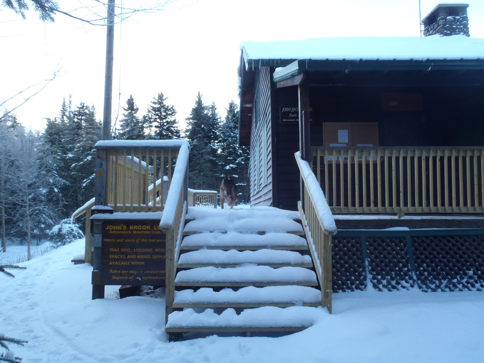
We reached JBL in about an hour and 15 minutes and took the right just past the lodge itself towards Klondike Notch. It was immediately evident that it'd be snowshoes from here on up. This trail doesn't get a ton of foot traffic (maybe some winter cc ski traffic) and I was breaking out a sometimes infrequently blazed but stunning winter wood-scape. Koda is a natural hiker and never steers me wrong (though I guess we haven't really hiked enough to test that hypothesis scientifically). Despite the infrequent blazes and unbroken trail he managed to follow the scent of hikers past below the snow. It was still slow going and the 1.3 miles to the intersection with the Yard Mountain trail stretched on.
By the time we reached it, I was drained and started munching on the pepperoni stick which has become (for better or for worse) a winter staple for me. There wasn't much moving water for Koda to drink so for the rest of the day we shared watered down Gatorade from my Nalgene. He also got a pack of tuna here so he'd have some steam for the ascent of Yard Mountain.
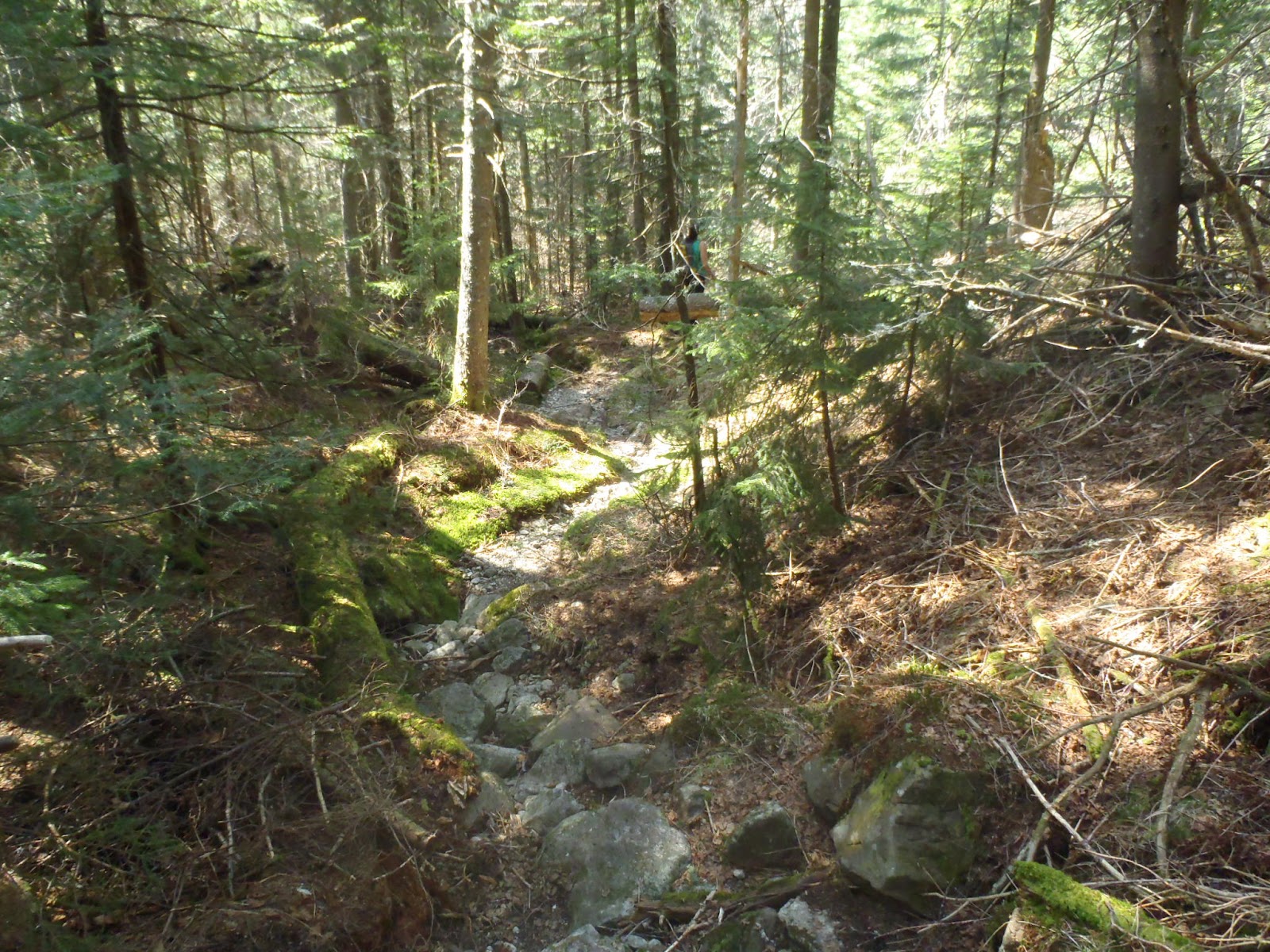
On paper and in the rest of the hiking season, the mileage and elevation gain for this next section is pretty standard high peaks hiking. As a novice winter hiker I was in over my head. Any gain in elevation meant increased snow depth. The Warm temps and bright blue skies meant wet and heavy snow. I was frustrated with myself, knowing I should have picked a hike where the trail was likely going to be packed out at least a little. It was dangerous for both myself and my young dog to be back on a seldom traveled trail in the middle of the week mucking through heavy deep snow. After some very successful 'road-less-traveled' hikes in the recent past (Blueberry mtn>Porter>Cascade, Hopkins>Giant) I didn't think seriously enough about the recent snow.
Waves of exhaustion over-swept me as we continued tromping through the snow. I put the tails on my snowshoes for the first time for added float. They were effective but were now heavier and more unwieldy, both aiding and increasing difficulty at the same time. Koda was flagging too. This was the hardest part for me. I could tell he was exhausted and needed lots of breaks (he usually doesn't need ANY and is impatient with me when I rest). He would flop over in the snow and bury his snout. I would too. It broke my heart and I felt dumb and selfish dragging him out here. He loves to hike but wouldn't stop until he couldn't as long as I kept going. I had to remember this feeling and implement it on my next trip planning. I can't risk his life and he can't speak up for himself. I've been warned several times on the boards as well that I need to go easy with the little guy until he's full grown. I felt immature for not listening to those who have gone before me.
When the climbing started in earnest, the thought of bagging the hike started to seem like a good idea. I'd plod along for a while, calculate, evaluate our condition and look back. We were about 3/4 of the way up Yard and it seemed at that point that it'd be less mileage out if we kept going forward so if we weren't injured, we should keep going. ANY signs of injury for Koda and we'd head right down to the interior outpost. Lets just get the regrets out of the way here so we can move forward with the rest of the hike. I regret not being able to enjoy the trail more. it was quite beautiful, offered some unique perspective and was all the solitude I could hope for. Once over the hump on Yard, I was so grateful to not be ascending anymore I didn't really poke around for a view.
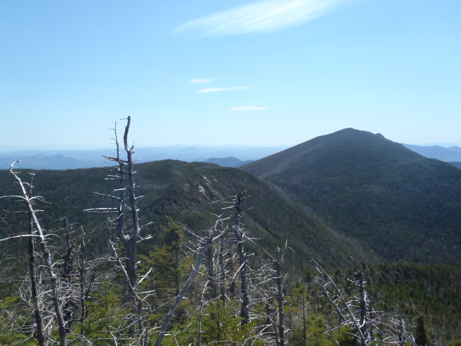
Koda and I both perked up a bit once we had gained the ridge. He had learned that if he stayed behind me, I would break the trail for him. At first I was tremendously relieved. This seemed to greatly reduce the difficulty of travel for him and also meant he couldn't run ahead and would be saving even more energy. As glad as I was at first, I began thinking what a lazy jerk he was. The ridge line hike between Yard and Big Slide was relatively flat, with deep snow and no evidence of recent human visitors. We followed snowshoe hare prints the entire ridge and were very grateful for their slight trail-breaking assistance. Even though things were better now that we weren't climbing I was still really exhausted and more than a little frustrated with myself on poor planning putting myself and dog in danger. The first faint appearance of boot prints might of been one of the more relieving moments in my high peaks experience. I knew we had to be very close. Sure enough we broke out of the tree line and onto that perfect little summit of Big Slide moments later. Such totally and complete relief.
Bright blue skies and crisp gust of between 10-15 mph greeted us on the summit. I had gotten pretty wet sloshing around on the ascent so I got very cold pretty quickly. We both had some tuna and banana chips, gulped some watered down Gatorade and took some pictures before scurrying off.Hiking on a packed trail was a complete day changer. We were able to make easy and quick progress and this caused us both to perk up and shake off the grueling ascent. I met a couple of guys pretty close to the top who told me The Brothers were ice-free. Knowing that the trail was packed and ice free this was the shortest and prettiest return route and so an obvious choice.
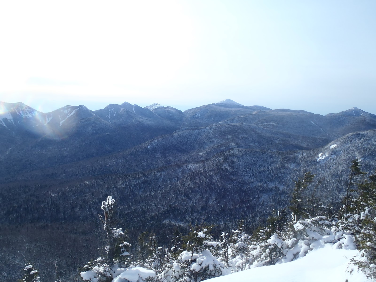
We made our way down, encountering a few groups of hikers, our first human contact of the day. Some clouds rolled in and the day went from bright blue to dappled gray. The hike along The Brothers was fast paced and as pretty as ever. Lots of varied perspectives of the great range. I sat for a minute after an hour and a half of steady descent and enjoyed two Christmas gifts from two amazing women. The first was a beautiful blue prayer bowl my sister gave me. I chimed it and made it ring, listening to the sound in the mountains. Jeanette found me a beautiful carved stone pipe crafted by a Native American artist. It's a platform-style pipe with the bowl carved into a bear which faces the user. This felt at home here too.
The rest of the hike went by with limited fuss and fanfare. It was great to move my body rapidly through the landscape and we made tremendous time back to the car. As has been our routine, I put him on leash about 10 minutes before we reached the trail head. When we got to the car I put out his bowl of wet food again and this time he killed the entire thing without breathing. I looked forward to a peaceful drive home with him completely passed out. After a quick stop at the Stewarts in Keene, we were making our way back to Albany. We were in the woods from 7am to around 1:30pm. About 6.5 hours covering just under 10 miles. This was Koda's fourth high peak and my tenth winter high peak. I'm learning a lot by doing as is my usual and learning some by listening to those with experience which is much harder for me. What people were trying to tell me about not hiking loops in the winter just didn't sink in until I was hiking and could see why. I had no idea what the return hike would be like. I was also told to not push Koda too far as he is still young and developing. Watching him struggle breaking trail with me was a real call to awareness. For the rest of the winter we are going to choose hikes which are either low mileage with some potential for trail breaking or medium mileage with high potential for broken trails. I am confident that there are a big handful of winter high peaks that we can do that fit these qualifications and I'm excited to have some rules to guide our hiking choices.
Thursday, August 23, 2012
BC trip Hike 1: Stein Valley Nlaka'pamux Heritage Park
We began or trip by flying into Vancouver and spending a few days exploring there. We hiked in two large parks, Stanley Park and Pacific Spirit Park, saw the Museum of Anthropology went to Granville Market and ate some awesome meals. We enjoyed the city quite a bit and found it easy to get around on their mass transit system.
We rented a compact and fuel efficient car (Toyota Yaris) for eight days and began our explorations of the province. We started by driving up BC-1 for 260 km (about 3 and a half hours northeast to the dry BC interior. While most are familiar with the dramatic rainforest and Alpine Lakes, the dry interior reminded me more of the not so distant rockies than anything.
The hike started with a cable ferry across the roaring Fraiser River. Just days earlier the ferry wasn't running due to spring run off. Once over the river we were on first nations land and were greeted by some obstinate cows not really interested in letting us pass. We drove about 10 km on dusty roads past ranches teeming with beautiful horses, cows and dogs and well worn houses and farm buildings. We reached a well developed and signed trailhead with an expansive view up the valley. Stein is a curroption of a native word meaning hidden as you can't really see the mouth of the valley from the Fraiser.
We began our hike damn well exhausted. We had not truly recovered from our jetlag, had urban hiked around 15 miles over the past two days and Jeanette was still battling a bad cough she had picked up after Camp Bisco. We were a site for sore eyes. They hike was pretty though and blessedly mild both in difficulty and weather. There was some rain in the forcast but nothing more materialized then a few fat drops. It was very dry and I was sweating pretty good from the heat. It was definetly a weird climate for those used to the Adirondacks. The subtle differences in vegetation and landform were really cool to notice. Nothing was completely alien but everything seemed slightly shifted or intensified. Trees bigger, different bark, even a slightly different raspberry-type berry. It kind of felt like we were tripping.
We purposefully took as much time as we could, more like strolling than hiking and reached the Devil's Starcase Campsite 3.3 miles invery grateful to take off our packs. The campsite was completely and looked like it could accomodate at least 20 tents. There was a really nice pit toilet and a large steel bear vault with a very tricky closure. If I could barely manage I felt good abour our chances with the grizzlies.
We got the tent set up in no time and before settling down to read for a while before bed, Jeanette went down to the river to take it all in for a few. We had both relaxed and I knew the river would be a pretty spot so I decided that now was the time. Squirrelled away in my pack was a 70's era Kings Massana turquoise Navajo bracelet made by Dorothy and Donny Smith, a husband and wife time active from the mid 60's to the late 80's. She was about to leave as i made my way down. She smiled and decided to stay for a moment and looked back at the river. The rocky, rooty and uneven proved a bit more of a challenge than I had anticipated and it took some effort and fanagling to get down on one knee. Just as I got situated she turned around with barely a moment to make a slightly perplexed face before... "Jeanette Carioto, moon of my life, will you marry me?"
We hugged and cried for several minutes and then both kind of chatted in a happy haze. We had packed in some beautiful meatloaf and beet salad from the Whole Foods next to our hotel and settled in for our engagement dinner at our kindly provided for dinner table. At this point in the night while camping Jeanette often reads for a bit in the tent and I'll go explore the area around the camp site. I almost always find something cool to look at or make friends with some bird or animal. Just west of the campsite was a large talus slope. I climbed up to an inviting rock about 150 ft upslope and snapped some pictures, taking it all in. The cliffs, the river the trees...this was a truly beautiful and peaceful place. The Stein River Valley is one of the few intact watersheds in British Columbia and mid week we had it all to ourselves.
The next day we began or hike by immediately climbing "The Devils Staircase", a section of switchbacks clinging high on the slopes of the valley. Though it wasn't exactly brutal hiking we took our time and enjoyed the dramatic and peaceful views. That morning at camp we had seen a huge raptor and think it may have been a golden eagle. High up on the hillside we saw a bald eagle far below us.
After getting off the staircase we reached our primary destination of the day. Thankfully I had read three different guide books because the intersection was completely unmarked. As one account from a guidebook said, turn right and step over the fallen log, following the path to the base of the cliffs. Here we had reached the largest petroglyph site In Canada. The First Nations people still living nearby had sent off their adolscent boys butt-ass naked into the Stein for their vision quest coming of age ritual. Here sleep deprived, fasting a exposed to the elements they had drawn on the cliff walls using a mixture of red ocher and water. Jeanette and I are anthropologists and this was a truly special moment for us. We marveled at the often very accurate representations of animals, warriors dancers, the sun and intricate geomoetric shapes and patterns. Each step we took along the cliff edge we discovered more glyphs from our kness to high above our heads.
After poring over the drawings for a long time and also sitting back on a rock to take in the total picture we eventually started to make our way down the trail. Now back close to the river again we made our way through several different types of forest. Towering pines surrounded us in one particularly lovely stretch that would give any stand of white pines in the ADK a run for it's money. It was one of my favorite places on the trip. Since this was part of a large Northville-Placid type through hike we didn't really have an end destination. At the site of an old prospectors camp we rested and turned back.
We returned for another long and relaxing night and camp still buzzing from our engagement and our stunning trip exploring the wonders of this sacred valley. I returned to my perch and thought about all I had to be grateful for, all that had happened this year and all of the brightness in our future and felt peaceful and at ease in my core. The next day was fantastically pretty and after a leisurely breakfast we headed back to the car. Our next step would be to drive due west, north of some of the tallest mountains in BC and head south down through Whistler to stay in Squamish and hike in Garibaldi Provincial Park the next day. This drive was jaw-droppingly beautiful and rugged as anything I had ever seen. We twisted along hillsides far above the Fraiser River and witnessed an ever-shifting mountainscape unfold before us.
| The lovely view from our room at the Holiday Inn morning of the trip |
We rented a compact and fuel efficient car (Toyota Yaris) for eight days and began our explorations of the province. We started by driving up BC-1 for 260 km (about 3 and a half hours northeast to the dry BC interior. While most are familiar with the dramatic rainforest and Alpine Lakes, the dry interior reminded me more of the not so distant rockies than anything.
The hike started with a cable ferry across the roaring Fraiser River. Just days earlier the ferry wasn't running due to spring run off. Once over the river we were on first nations land and were greeted by some obstinate cows not really interested in letting us pass. We drove about 10 km on dusty roads past ranches teeming with beautiful horses, cows and dogs and well worn houses and farm buildings. We reached a well developed and signed trailhead with an expansive view up the valley. Stein is a curroption of a native word meaning hidden as you can't really see the mouth of the valley from the Fraiser.
| The start of our Stein Valley Journey. Little does she know... |
We purposefully took as much time as we could, more like strolling than hiking and reached the Devil's Starcase Campsite 3.3 miles invery grateful to take off our packs. The campsite was completely and looked like it could accomodate at least 20 tents. There was a really nice pit toilet and a large steel bear vault with a very tricky closure. If I could barely manage I felt good abour our chances with the grizzlies.
We got the tent set up in no time and before settling down to read for a while before bed, Jeanette went down to the river to take it all in for a few. We had both relaxed and I knew the river would be a pretty spot so I decided that now was the time. Squirrelled away in my pack was a 70's era Kings Massana turquoise Navajo bracelet made by Dorothy and Donny Smith, a husband and wife time active from the mid 60's to the late 80's. She was about to leave as i made my way down. She smiled and decided to stay for a moment and looked back at the river. The rocky, rooty and uneven proved a bit more of a challenge than I had anticipated and it took some effort and fanagling to get down on one knee. Just as I got situated she turned around with barely a moment to make a slightly perplexed face before... "Jeanette Carioto, moon of my life, will you marry me?"
| Kings Massana Turquoise and Red Coral "engagement" bracelet |
| The start of our next big adventure |
| At the dining room table looking over the hike |
| After dinner explorations |
| The Stein River is impossibly blue |
| High up on the talus slopes above the Stein |
| One of the first we saw |
| the rock was covered when you took a step back |
| one of many human figures |
| The cliffs at the edge of the Cantilever Range soaring above us |
| Looking deep into the Stein River Valley |
| ever rushing waters |
| waiting for our ferry to return |
| One of many views driving between Lytton and Squamish |
Wednesday, August 22, 2012
The Santanoni Range: Our 46er Finish 6/09/12
We started our hike late Friday afternoon under fairly sunny skies though there was some rain in the forcast. Once we got under way, some gray skies started rolling in, getting more and more threatening. The first portion of the hike in is along a road and goes fast. There is a hard right onto the trail proper which started out pretty and got awfully rugged (muddy, rocky and heavily eroded) awfully quick. I think we both had a lot of nerves about our last big trip of the 46ing journey and hadn't seen each other for a few days so we bickered a bit on the way in. I made some sort of smart ass comment about how it was going to rain soon and we both started picking up the pace. Thunder rumbled more and more intensely. About a mile before the lean to, a significant reroute was marked around some even worse trail. We pushed through scrubby pine and swung off of trees to keep our balance while trotting with three days worth of backpacking gear. We started to get kind of giddy in our race to the lean to and any animosity or irritation between us dissolved as the rain started to fall. Before we got too wet we reached the lean to. As we did, it immediately started raining harder. We gleefully settled in for the night. We had passed two guys on the way in who got to the lean to at the begining of the storm too. We immediatly invited them to share it with us for the night but they seemed intent on setting up their tent so we had it all to ourselves all weekend.
The next morning we got it together pretty early and got on the trail. On the way in, at the reroute start, there was a small cairn. I assumed that this was the start of the herd path to Times Square though I was a little unsure as it was pretty small. I was able to rationalize that since there is now a trail reroute, the herd path start probably got a bit rerouted too. Here, me being overconfident got us into some trouble. First off, I hadn't checked any trip reports beforehand which I had been pretty vigilant with over our last handful of trips and the info had been pretty valuable. I might have gotten better info as to herd path start and how it was affected by the reroute. Secondly, I didn't pull out the McMartin map, sticking to the ADK map. The McMartin map has the herd paths and I would have very quickly seen my mistake. I left it in the freaking lean to.
So we headed into the woods at the cairn and quickly lost any sign of a herd path. I was still sure that it was nearby as I thought I remembered that the herd path went south of Bradley pond. So if I took a bearing, stayed south of the Pond and hit Panther Brook, I'd HAVE to stumble into the herd path. The trees, christmas tree sized pines, were heavy with last nights rainfall and dew and quickly soaked me as I pushed through the brush. Jeanette trusted my judgement (oops) and followed but I can't say that either of us were pleased. We followed the southern shore of the pond and got some pretty sights.
| A boat stashed in the woods in what looks like ship shape. |
| Impromptu Bradley Pond bushwack |
| Those are some lovely cascades...lets climb em! |
| Jeanette before and after shots: before finding the herd path |
| After finding the herd path!!!! |
| Almost to Times Square, the view back towards Bradley Pond, the Mac Range and beyond. |
| an ocean of fog |
| Cold River and the Seward Range |
We rested for a while and like Allen, got visited by a summit bird. Jeanette (and I) were very curious about a certain bird song we often herd in the Adirondacks. As a kid, my dad would whistle back to them and convince my sister and I he was talking to them. Which I now do to Jeanette haha. So this little bird with these brown almost hawk like wings, a striped black and white head and a yellow spot on it's cheek hopped around us for several minutes. It took off, perched on a nearby branch and lo and behold, sang the ellusive song! We now had all the identifiers we need to find out what kind of bird it is. It's called a white-throated sparrow. About a month later we decided to climb Phelps for sunrise and while we were completely socked in, we were visited again by WT sparrow and were treated to an extensive serenade which Jeanette managed to film. Such special moments!
| Summit trillium? |
| The view from Santanoni; Pure wild Adirondacks |
| Santanoni from Panther |
In the lean to that night we cooked a nice dinner, at some chocolate and drank a bottle of Finger Lakes ice wine I had gotten for Jeanette for Christmas and took in a lovely and restful evening alone in a lean to. I guess I didn't spend much time reflecting on the past because I feel in the middle of a fluid lifestyle more than someone who had just closed a door or finished a chapter. As I sit here writing this, I'm planning several camping and hiking trips for the coming months and beyond. I love these mountains with all my heart and feel so grateful for how they've changed me. I feel like I am finally a man. A man shaped by mountains, mud, weather, exhuastion, exaltation and solitude.
Labels:
High Peaks,
navigation mishaps,
Santanoni Range
Wednesday, May 16, 2012
Dix Range in Pictures 5/11-12/12
![]() |
| Slide Brook Lean to |
![]() |
| New spring growth next to the lean to |
![]() |
| A bridge returns to nature |
![]() |
| Painted Trillium |
![]() |
| Perfect woods |
![]() |
| A cold morning start |
![]() |
| First views of Elk Lake from Macomb |
![]() |
| Macomb's famous slide |
![]() |
| Rock star!!!! |
![]() |
| The view north |
![]() |
| uninhabited |
![]() |
| The Dix Range from Grace |
![]() |
| Grace from Hough |
![]() |
| mossy roots |
![]() |
| Looking south towards macomb |
![]() |
| Summit of Hough |
![]() |
| My partner in crime |
![]() |
| Lillian Brook herd path |
Subscribe to:
Posts (Atom)